Welcome
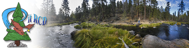
A Google Earth Demonstration Model for Pit Resource Conservation District
Projects in Northeastern California.
Users Guide:
Please make sure the "Terrain" layer is checked in the "Layers" section of the Google Earth sidebar. You may want to turn most of the other layers off to prevent clutter on your screen.
To begin the tour, you can do this automatically by first selecting the "Pit RCD" folder and then clicking the play (arrow button) at the bottom of the "Places" section on the sidebar.
You can also take a manual tour by clicking on the project location sites in the sidebar or on the map one at a time.
For this demonstration, each of the locations contains further explanations and links to web pages or photo galleries for even more information.
Note: if you are using automatic tours, you may want to check the "Show balloon when tour is paused" box under the "Touring" tab in your Google Earth Preferences (Mac) or Tools Options (Windows), as well as increase the "Tour Pause" time to at least 15 or 20 seconds so that the information balloons will open automatically and you will have time to read them.
To view the multi-media sequence Photo Galleries on the Pit RCD web site, you will need the QuickTime Player.
|
|
Introduction to Pit Resource
|

|
|
The Pit Resource Conservation District (Pit RCD) in Northeast California welcomes you to this Google Earth tour to learn about the RCD and its projects. The Pit RCD web site summarizes the major resource concerns within the Pit RCD area, as well as the RCD’s most recent projects. |
Visit The Pit RCD Web Site |

|
|
PK DeForest Ranch Project |
|

Fall 2007. Water gap along Ash Creek is complete. Along with the new fence, livestock management has been improved at this pasture location where they are fed hay during the winter. |
|
|
Paul and Karen DeForest own 6,468 acres in Ash Valley that they use for livestock and hay production. To date, the Pit RCD assisted them with the: 1) installation of roughly 1,320 feet of fencing along the northern portion of their property and roughly 2,700 feet of fencing along the southern portion to better manage livestock along Ash Creek; and 2) installation of a “water gap” in the newly southern fenced area. |
|
|
|
|
Twin Pine Ranch Project |
|

October 2006. Construction is complete and a new spillway has been built that will transport water to the original stream channel. |
|
|
Twin Pine Ranch is a 560-acre ranch in Northern CA, consisting of a rangeland (grassland, sagebrush, juniper woodland and cultivated fields. This project included stabilizing approximately 1,500 feet of an Ash Creek tributary channel by creating a “grassy swale” around the channel and fencing both sides of the swale to provide channel protection from livestock. |
|
|
|
|
North Fork Ash Creek Project |
|

Pre project picture of North Fork Ash Creek, June 2007 |
|
|
The Pit River drainage and its tributaries have been reported to have high sediment and turbidity levels. The main channel of Dutch Flat Creek and the nearby section of the North Fork of Ash Creek are tributaries of Ash Creek that joins the Pit River near Lookout, California. The project re-established flood plain connection on the North Fork Ash Creek reach, raising the local water table, reducing the rate and intensity of runoff from the ranch, and significantly improving aquatic and riparian habitat quality.. |
|
|
|
|
Dutch Flat Creek Project |
|

Excavator starts removing soil at vertical bank locations on Dutch Flat Creek, June 2007. |
|
|
The Pit River drainage and its tributaries have been reported to have high sediment and turbidity levels. The main channel of Dutch Flat Creek and the nearby section of the North Fork of Ash Creek are tributaries of Ash Creek that joins the Pit River near Lookout, California.On the Dutch Flat Creek reach, the project built on the natural tendency of the stream to widen much of the gully and create an inset floodplain surface for the dissipation of flood flows. |
|
|
|
|
Shaw Ranch Project |
|

Shaw Ranch project area after the J-hook rock vanes were placed. Photo taken Fall, 2007. |
|
|
The Shaw Ranch contains over 2.5 miles of the main stem Pit River that slowly meanders through Big Valley. The Shaw Ranch has a history of progressive, innovative resource stewardship practices and is a model for other local ranches. The goal of this project is to serve as a demonstration project for the Pit RCD. The project will benefit water quality by preventing valuable land loss due to accelerated rates of erosion, reducing sediment loading, minimizing nutrient loading, increasing dissolved oxygen, and lowering water temperatures. |
|
|
| |
Rose Creek Canyon Project |
|

Pre construction view of Rose Creek, Fall 2006. |
|
|
Like many tributary streams and associated meadows in the region, Rose Canyon Creek is deeply incised (see image above) and contributes large amounts of sediment downstream into its lower reaches and eventually into the Pit River. The goals of the landowners were to restore Rose Creek Canyon to its original channel, reduce the loss of land and sediment downstream, and restore meadow vegetation. |
|
|
|
Tour End of the Pit Resource Conservation District Projects
|
|
|
|
We hope you enjoyed this Google Earth tour of the Pit RCD Projects. Check our web site for new future projects and to learn more information about the Pit RCD. |