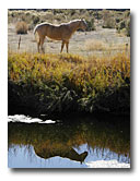
The confluence of the North and South Forks presents many and varied management problems. Runoff from the city of Alturas, the city septic treatment plant, channel lining of the North Fork through Alturas, and many channelized reaches featuring high rates of bank erosion combine to create problems that reach far downstream, and upstream too. Various projects and data collection efforts are in progress to improve riparian condition for this confluence zone on private and pubic lands. Experience gained in these efforts will be used to address similar sites throughout the area, and will help guide assessment and planning processes. Cooperation between the City of Alturas and Central Modoc Resource Conservation District (RCD) is leading to the initial phases of a stormwater treatment project. View the Cubical Panorama of the North/South Fork Pit River Confluence (1.5 Mb) |
|
|||||||||||||||||
