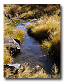
The North Fork of the Pit River is fed by various tributaries that flow west from the Warner Mountains, including Joseph, Thoms, Gleason and Parker Creeks. The upper reaches of the North Fork seem to be in good condition, but severe bank erosion is a significant concern in the lower reaches. Monitoring and assessment throughout the North Fork drainage are building a data base that will lead to restoration work and improved management. View the Cubical Panorama of the North Fork Pit River (1.3 Mb) |
|
|||||||||||||||||