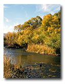
The South Fork of the Pit River drains the South Warner Mountains. Numerous tributaries come together in Jess Valley, and flow through the South Fork Canyon to reach the valley near Likely. One of eight water quality monitoring sites for the Upper Pit River is located in the canyon near this site. New proposals for hydroelectric development in the canyon could dramatically change flows in the reach in this panorama. This area is a popular recreational fishery, and is easily accessible by vehicle. View the Cubical Panorama of the South Fork Pit River (1.1 Mb) |
|
|||||||||||||||||