|
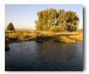
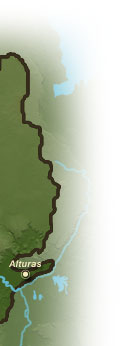
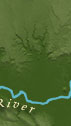
The Warm Springs Valley is the highest reach of the Pit River. Collecting drainage from the Devils Garden to the North (a vast basalt table land) and the various small mountain ranges to the south, it is here that the Pit really becomes a river. This reach of river, and most of its tributaries too, were diverted for agriculture by the end of the 1800s, and today numerous dams and channelized reaches make a river that is quite different from the Pit River of 150 years ago.
We can�t turn back the clock, but we can control where our future management will lead us. Knowledge of the costs and benefits of our existing watershed management is necessary for the creation of improved conditions in the future.
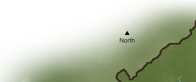
Your journey will continue by exploring any of the interactive 360 degree panorama views on the map.
To experience the exciting multimedia panoramas, video and audio-visual stories, you'll need the QuickTime player. Please see the Plug-In Information.
|